Environmental data science, editorial solutions & scientific outreach
Effectively communicate your scientific data
Effectively communicate your scientific data
We are a team of environmental scientists dedicated to making sense of your environmental data and solving data driven environmental questions. With our combined expertise in remote sensing, ecological modelling, field surveys, tropical ecology and agroforestry, data science (ML/AI) & data rescue we can provide end-to-end research & development solutions. We help you effectively communicate research results, reaching both professional and general audiences.
our expertise
We support your data analysis and synthesis, ranging from remote sensing data processing to machine learning.
Our editorial services quickly draft a manuscript or grant framework. We help you communicate your research, through formal and informal channels.
We provide guidance in field survey planning, sampling protocol design and hardware & software development.
past & ongoing projects

BlueGreen Labs provided data management and machine learning software development expertise for the EU Joint Research Center (EU JRC) within the context of a landscape image segmentation project.

We provide protocol development and data processing expertise in support of this IFPRI led project to mitigate basic risk in smallholder farmer insurance.

We provide remote sensing validation expertise in support of product development.

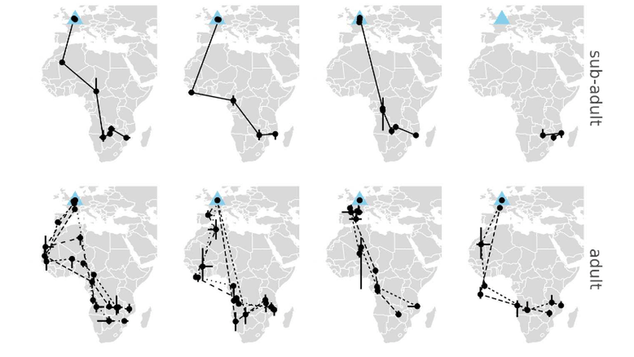
BlueGreen Labs contributes to the field of movement ecology through the research of Lyndon Kearsley with a long running project on monitoring the (movement) ecology of swifts.

We provide open hardware development in support of (academic) research.

We provide a range of open source software packages in support of (academic) research.

We detailed the protocol for the implementation of cameras within the PhenoCam US and Integrated Carbon Observation System network.

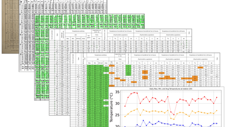
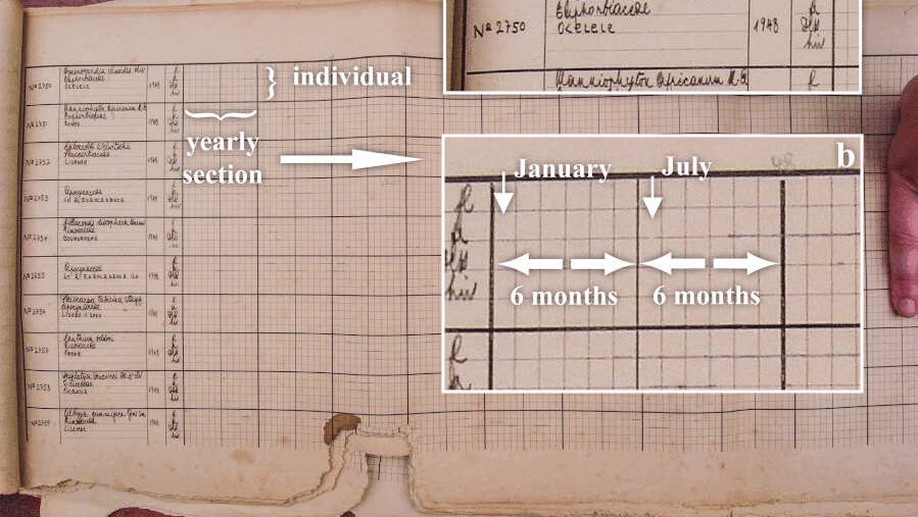
BlueGreen Labs has expert knowledge on (citizen science based) data recovery. In particular, we led the COBECORE project to develop a multi-faceted database by making the archives of the Institut National pour l’Etude Agronomique du Congo belge digitally accessible.

Project Lead. This project strives to transcribe old observations of tree life cycle events (flowering, leaf shedding, fruit dispersion), in central African Rainforests, which are key to understanding a tree’s functioning.

A scientific outreach project to engage citizens with observing and enjoying phenology in VR.

Research paper development on banana pests and diseases, and the sustainability of smallholder banana-producing farms

Analytical and editorial support for research on food security crops.

We used a combination of historical (1958) aerial photography and contemporary remote sensing data to map long-term changes in the extent and structure of the tropical forest surrounding Yangambi (DR Congo) in the central Congo Basin.

Central African climate data rescue using a computer vision, deep learning and crowd sourcing methods.
Most recent academic work

News, tutorials and more


Macro Ecology, Plant Physiology, Remote Sensing, Data Science & Rescue, Movement Ecology
Tropical Ecology, Biodiversity, Agroforestry, Food Security, Gender Equality, Field Surveys
Bird migration, Bird behaviour, Pallid swift, GPS logging, Movement ecology
get in touch